Louisiana Map v 1.0

0/5,
0
voti
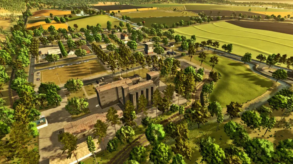
This map depicts the actual topography of an area in the US state of Louisiana that is mostly recognized for its agricultural concentration. The region supports cattle husbandry and the production of maize for silage in addition to the large areas devoted to rice cultivation. For anyone wishing to investigate the intricacies of agricultural production in this region of the nation, the meticulously rendered environment offers an immersive and genuine experience that faithfully captures the local topography.
There are four fields that may be purchased.
Andrade ML, Renegados Modding, and ML Studio are credited.
There are four fields that may be purchased.
Andrade ML, Renegados Modding, and ML Studio are credited.
Scarica i file dell'ultima versione
Versione: v 1.0Aggiornato: 1 anno fa
Dimensione totale: 150.19 MB
FS25_Louisiana_Map_fs25planet.zip
direct scaricare
· 150.19 MB
· aggiunto 1 anno fa
Questo file è stato scansionato dall'antivirus ed è sicuro.
Altri dettagli
Informazioni su Mod
| Ultima versione | v 1.0 |
| Gioco | FS25 |
| Categoria | Mappe |
| Scarica | 304 |
| Creato | 1 anno fa |
| Ultima scansione dei virus |
0/98
Altri dettagli |
Ti potrebbe anche piacere »


_fs25planet.jpg)
0 Commenti
Non ci sono commenti. Sii il primo a commentare!